
Sources for Hilo Neighbors
A useful block lookup assigns one role to each source. County GIS supplies parcel shape and adjacency. Real Property Tax, or RPT, supplies the owner and property-address fields documented in the County’s surrounding-owner workflow. Other sources add a date, public role, or physical change. None becomes a household roster.
| Block source | What it shows nearby | Access |
|---|---|---|
| County GIS parcel layer | Parcel shapes, TMKs, planning context | Free Web Map and FeatureServer |
| RPT spatial buffer | Parcel ID, owner, property address | Official qPublic workflow |
| Planning Web Map | Zoning, land use, subdivisions, permits | Online or Planning counter |
| Public voter fields | Name, district, precinct, voter status | Official election channels |
| EPIC and BOC | Permit dates and recorded parties | Portal, office, or written request |
| Community organizations | Public projects, meetings, contacts | Organization and County records |
Record the date of every result. An RPT owner can be a person, trust, business, or other entity. A property address may differ from the owner’s mailing address. Neither field proves who slept at the property last night.
Start Hilo Neighbor Searches by Parcel
Use the County GIS Web Map to turn the known address into a tax map key, or TMK. The search line accepts an address or TMK with autocomplete. Select the match, zoom to the parcel, and switch on the Parcels layer. Copy the key exactly before moving to RPT.
The map view answers a geographic question: which lots surround the starting place? It can also display zoning, land use, subdivisions, addressing, and planning layers. It does not identify the owners. The parcel metadata expressly says there is no ownership information and that its geometry is a guide, not a survey or title ruling.
The assigned County parcel FeatureServer capture shows the public layer behind a Hilo block search.
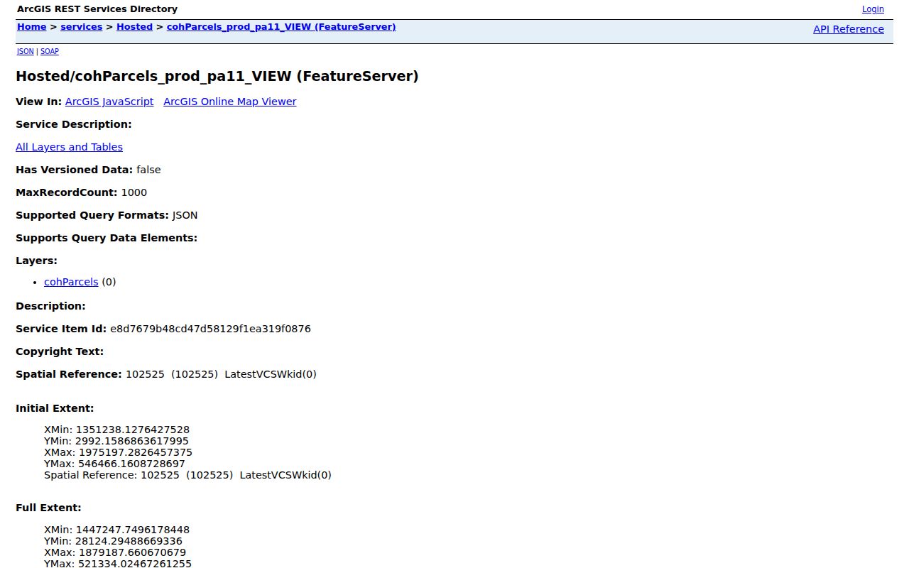
Note: The parcel metadata date is May 8, 2023; record the live map date and check later records before relying on a boundary.
Build a 300-Foot Hilo Block
The County’s official surrounding-owner instructions provide a reproducible buffer method. The 300-foot distance is an example, not a legal definition of a neighborhood. It is still a practical way to hold the search radius steady and avoid selecting lots based on a desired result.
- Find the starting parcel in the County RPT search and open its Map view.
- Select the parcel until it turns blue, then open the Spatial Selection Tool.
- Choose Buffer and the Parcels layer. Enter the distance in feet and run Buffer.
- Review the outlined lots and information boxes. Open Results for Parcel ID or TMK, Owner, and Property Address.
- Keep only the minimum fields needed. Do not republish owner mailing labels.
The Mailing Labels control can choose whose addresses appear and can export Excel or 5160 labels. That function was built for notice and parcel work. Its presence does not make a mailing address an occupant field. The live qPublic parcel card was blocked during research, so verify its current layout and privacy notice in a browser.
Read Hilo Neighbor Results Carefully
Three labels do most of the work. Parcel ID or TMK ties the row back to land. Owner names the party carried on the assessment record. Property Address identifies the parcel’s situs, or physical site. Mailing Labels may instead use an owner’s mail destination. Keep those concepts separate.
- Adjacent parcel
- A lot that touches or sits next to the starting parcel on the map.
- Buffer
- A set distance drawn around a selected map feature.
- Owner of record
- The person or entity shown by the custodian on a given date.
- Situs address
- The physical address of the parcel, which may differ from the mail address.
GIS boundaries may be generalized, and a deed or survey can control over a map edge. For title, move from the TMK to the Bureau of Conveyances. Its online index covers 1976 forward, while earlier records route through the public reference room or a written request.
Permits Add Hilo Block Context
The EPIC permit search can place dated physical work around a block. Its documented filters include Permit Number, Project, Address, Permit Type, Status, State, Records Updated, and Last 1 Year. The system launched in July 2021. A blank result does not settle earlier work that may be in another system or on paper.
A permit may show the project address, number, type, status, dates, inspections, conditions, plans, or payments when those fields are public. It is not a list of Hilo neighbors. Use it to explain construction, alteration, or inspection activity. Public Works can help by phone at 808-961-8321, fax at 808-961-8630, or email at public_works@hawaiicounty.gov.
BOC adds a different kind of date. A recorded deed names parties and a legal description in a transaction. Confirm the instrument number and recording date. Never turn a grantor or grantee into an unqualified claim about current occupancy.
Hilo Neighbor Voter Data Is Narrow
HRS §11-97 makes the voter’s full name, district, precinct, and status public. The complete registration affidavit is not a block directory. Identification numbers, Social Security number fragments, signatures, and other protected fields stay confidential. Address confidentiality can also apply for good cause.
Use the official voter registration lookup for a person checking their own status, or contact Hawaiʻi County Elections at 25 Aupuni Street, Room 1502, Hilo, 808-961-8277. For block-level civic context, the state’s registration and turnout statistics are safer than seeking personal affidavits.
Evidence limit. A precinct is an election area, not a household boundary, and registration status does not prove present occupancy at a parcel.
Hilo Neighborhood Groups Add Context
Hilo’s public organizations can identify a place, community issue, meeting, or civic project. They cannot be treated as directories of members. The research found no official public Hilo neighborhood association directory with block-by-block resident coverage. Use public contacts and County records rather than asking a group to reveal private membership.
Downtown Hilo Improvement Association
Public history and projects concerning Downtown Hilo, preservation, and work with the County.
Halai Kumiai
Organization statements about downtown communication with County authorities.
Hawaiian Civic Club of Hilo
The Association of Hawaiian Civic Clubs lists the local club and charter context, not a member roster.
Hilo Woman’s Club
Public civic history dating from 1921, while membership remains private.
Keaukaha Community Association also appears in an official County Planning record. That item proves civic participation in the cited proceeding, not who belongs to the group today. County agendas and testimony can support a dated public role where the association’s own page cannot.
Official Hilo Records Beat Inference
Commercial neighbor tools often merge old directories, marketing files, and guessed relationships. Their speed can hide stale addresses and weak identity matches. Official records are narrower, but each names its custodian and record purpose. That makes their limits much easier to state.
| Source type | Strength | Main caution |
|---|---|---|
| County GIS | Nearby parcel geometry and TMK | No ownership data |
| County RPT | Dated owner and property fields | Owner is not occupant |
| BOC or EPIC | Dated instrument or project | Names reflect a record role |
| Commercial category | Broad hints gathered quickly | Unknown refresh dates and inferred links |
For a property concern, use the parcel, RPT, permit, and deed chain. For a public community concern, use meeting records and organization contacts. Do not merge those paths into a profile of people who happen to live close by.
Request Hilo Block Records Offline
If a portal fails, take the TMK and address to the office that owns the record. County Planning handles address and map questions at 808-961-8167 or planning@hawaiicounty.gov. RPT handles assessment records. Public Works handles EPIC questions. The Bureau of Conveyances accepts older-record work through its reference room and written requests.
A request under the Uniform Information Practices Act should name an identifiable permit, map, assessment-review file, or date range. Ask for the public version and expect lawful redaction. The Hawaiʻi State Archives and Mookini Library are better routes for historical maps, directories, and neighborhood context.
Do not bypass a login, CAPTCHA, payment control, or redaction. A portal outage is a reason to call the custodian, not a reason to guess.
Privacy Stops Hilo Neighbor Lookups
Public parcel facts do not erase personal boundaries. Hilo neighbors may include renters and household members who appear nowhere in land records. Utility customers, complete voter affidavits, driver records, protected vital files, sealed courts, and Address Confidentiality Program information are not sources for a block list.
Minimal disclosure is the right standard. Keep TMKs and public record dates when documenting a planning or property question. Avoid publishing owner mailing-label exports, guessed occupants, phone numbers, or a combined dossier. A missing address can reflect confidentiality, not absence.
Lawful use. Use neighbor records for property questions, civic work, reconnecting, and personal safety. Never watch, harass, threaten, impersonate, or dox another person.
For a complete named-road chain, use the Hilo street directory. A neighbor search should stay with the immediate radius, the parcels around it, and public community context.